
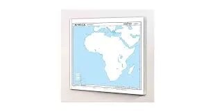
Africa Physical Map (100x70cm)
Description
The “Africa Physical Map (100x70cm)” is a large-format educational wall map that highlights the continent's physical geography, ideally suited for classroom or laboratory display at 100×70 cm.
Map Content Overview
Title: Africa Physical Map
Size: 100×70 cm (large, detailed display size)
Key Map Features:
Topographical representation showing major mountains (Atlas, Ethiopian Highlands, Drakensberg, Kilimanjaro, Rwenzori)
Major rivers (Nile, Congo, Niger, Zambezi), lakes (Victoria, Tanganyika, Malawi), and deserts (Sahara, Kalahari, Namib)
Relief shading or color gradation to distinguish between mountains, plateaus, valleys, and plains
Labeling of physical regions and zones (Sahel, Congo Basin, Great Rift Valley)
Coastal outlines highlighting major gulfs, bays, and capes (Gulf of Guinea, Cape of Good Hope)
Features biomes when possible: rainforest, savanna, desert, highland
Educational Use
Essential for geography and earth science instruction, demonstrating Africa’s terrain, climate regions, and major water bodies.
Designed for easy readability, with high-contrast color coding and graphic symbols for topographic features.
For a print-ready map:
Use high-resolution vector or raster format for clear large-scale display
Include legend, scale bar, and main physical region labels for classroom clarity
Additional customization (biome overlays, multi-language labeling, or specific physical features emphasis) can be provided if requested.
Specifications
| Model No. | N-C120 |
|---|


