
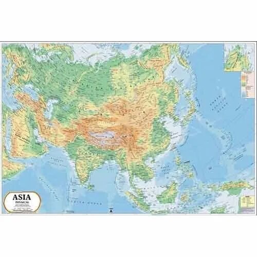
Asia Physical Map (100x70cm)
Description
The “Asia Physical Map (100x70cm)” is a large-format educational map showcasing the physical geography, landforms, and natural features across Asia, ideal for classroom or laboratory wall display at 100×70 cm.
Map Content Overview
Title: Asia Physical Map
Size: 100×70 cm (provides detailed coverage for classrooms)
Key Map Features:
Relief shading or color gradation for mountains (Himalayas, Altai, Pamirs, Tien Shan, Caucasus), plateaus (Tibet), plains, valleys, and basins
Major rivers (Yangtze, Ganges, Indus, Mekong, Amur, Lena, Ob) and lakes (Lake Baikal, Caspian Sea, Lake Balkhash)
Key deserts and regions: Gobi, Taklamakan, Thar, Arabian, Siberian tundra and taiga
Labeling of peninsulas, islands, and other notable physical regions: Arabian Peninsula, Indian Peninsula, Kamchatka, Malay Archipelago
Biome overlays (rainforest, steppe, savanna, coastal wetlands, tundra)
Surrounding oceans and seas (Pacific, Indian, Arctic, South China Sea, East China Sea, Arabian Sea)
Educational Use
Utilized in geography, earth science, and environmental studies to teach about Asia’s topography, major ecosystems, and global geography.
Designed for legibility, with high-contrast relief shading, clearly labeled features, and a legend for physical symbols.
For printing:
High-resolution vector or raster sources recommended for clarity at a large scale
Include legend, scale, and orientation marker (compass rose) for classroom effectiveness
Further customization (e.g., focus on specific regions or climate overlays) can be provided for tailored teaching needs.
Specifications
| Model No. | N-C127 |
|---|


