
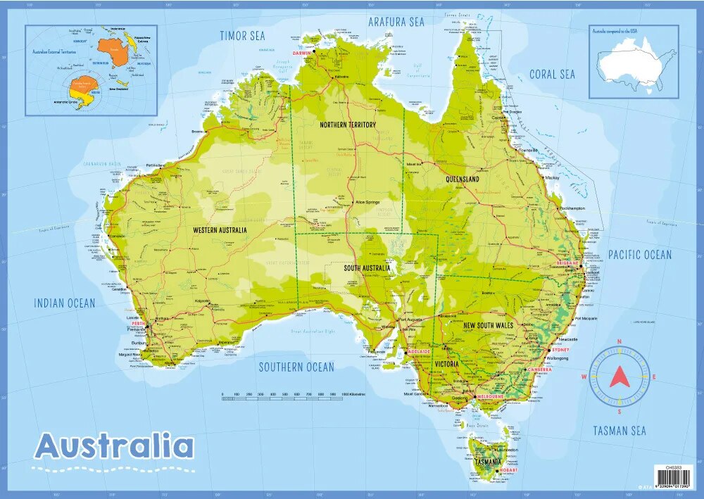
Australia Physical (100x70cm)
Description
The “Australia Physical (100x70cm)” is a large-format educational map displaying the physical geography and landforms of Australia, designed for classroom or laboratory wall display at 100×70 cm.
Map Content Overview
Title: Australia Physical Map
Size: 100×70 cm (optimal for visual detail and classroom visibility)
Key Map Features:
Relief shading or color gradation indicating mountains (Great Dividing Range), plateaus, deserts (Simpson, Gibson, Great Victoria), lowlands, and coastal regions
Major rivers (Murray, Darling, Lachlan), lakes (Lake Eyre, Lake Torrens), and drainage basins
Notable regions: Outback, Nullarbor Plain, Kimberley Plateau, Cape York Peninsula, Great Barrier Reef (offshore, if included)
Biome or vegetation overlays for rainforest (Daintree), savanna, desert, temperate forest
Surrounding ocean labels (Indian Ocean, Pacific Ocean, Tasman Sea, Coral Sea)
Clear legend for elevation, terrain, and key physical symbols
Educational Use
Widely used in geography and environmental science lessons to illustrate Australia’s landforms, ecological regions, and significant features.
Designed for legibility from a distance, high-contrast shading, and ample labeling for all major physical components.
For print:
High-resolution vector or raster maps are recommended to retain clarity at large formats
Legends, elevation keys, and scale bars should be included for reference
Further customization (with more biomes, climatic overlays, or specific labeling) is possible according to teaching or display needs.
Specifications
| Model No. | N-C126 |
|---|


