
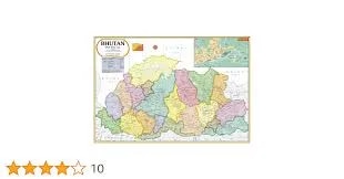
Bhutan Map (70x100)
Description
The “Bhutan Map (70x100)” is a large-format educational wall map detailing the geography, towns, and topography of Bhutan—sized for classrooms, offices, or libraries at 70×100 cm.
Map Content Overview
Topographic map of Bhutan showing elevation with color shading and bordering countries China, Nepal, India, and Bangladesh
Title: Bhutan Map
Size: 70×100 cm (excellent for clear group instruction and reference)
Key Map Features:
Clearly outlined national borders of Bhutan, with neighboring countries labeled: China, India, Nepal, and Bangladesh
Major towns and villages marked, with the capital “Thimphu” noted
Topographic shading/color gradation to show elevation, highlighting Bhutan’s highly mountainous landscape (Himalayas) with peaks like Kula Kangri (7,554 m) labeled
Major rivers, lakes, valleys, and elevation zones illustrated
Latitude and longitude lines and a scale bar for orientation and classroom learning
Legends for physical features and elevation colors
Road, trail, and tourist destination icons can be added if required
Educational Use
Used in geography, earth science, and social studies to identify Bhutan’s location, regional topography, cities, and neighboring countries.
Designed for high visibility, accurate labeling, and clear demarcation of both physical and human geography.
For print:
Provides a combination of political and physical features for all-purpose educational use
Available for physical (relief) or political overlays, and can be customized for multilingual needs or extra topical details as required.
Specifications
| Model No. | N-C149 |
|---|


