
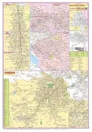
Delhi & It's Neighbourhood Map (70x100cm)
Description
The “Delhi & It's Neighbourhood Map (70x100cm)” is a large-format, laminated wall map designed for educational and classroom use, clearly illustrating Delhi and its surrounding NCR (National Capital Region) areas, including neighboring districts and major transport routes.
Physical Specifications
Size: 70 × 100 cm, offering high visibility and detail for group instruction and reference.
Material: Multicolour printing on 80 GSM map litho paper, hot-sealed lamination with 30-micron polyester on both sides for durability and easy cleaning; usually fitted with plastic rollers for easy wall mounting.
Languages: Typically available in English; certified by the Survey of India for accuracy.
Map Content and Features
Shows the full territory of Delhi (NCT), including its districts, major roads, Metro lines, and urban centers.
Clearly marks neighboring NCR cities—such as Gurgaon, Noida, Ghaziabad, Faridabad, Sonipat, Bahadurgarh, and Tigaon.
Displays district and municipal boundaries, landmarks, highways (NH1, NH8, NH24), and major railway stations and airports for comprehensive navigation.
May feature a color-coded index of Delhi neighborhoods, important government buildings, tourist sites (Red Fort, Qutb Minar, Lotus Temple), and river features (Yamuna).
The map provides references to adjacent states (Haryana, Uttar Pradesh), enabling context for regional studies and civics lessons.
Some versions include a legend, district/city index, and up-to-date reference info for quick educational use.
Classroom and Educational Use
Essential for teaching geography, civics, transport planning, and urban studies related to India’s capital region.
Useful for competitive exam prep, history/social science lessons, and as a location guide for projects and travel.
The large, durable chart ensures all students can easily study boundaries, routes, and neighborhood structures in detail.
This map is a critical classroom reference for understanding Delhi’s location, layout, and relationship to its neighbors, supporting detailed and up-to-date regional education.
Specifications
| Model No. | N-C308 |
|---|


