
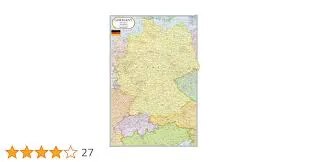
Germany Map (70x100)
Description
The “Germany Map (70x100)” is a large-format educational wall map displaying the country of Germany, suitable for classroom, office, or laboratory display at 70×100 cm.
Map Content Overview
Title: Germany Map
Size: 70×100 cm (ideal for detailed country coverage in learning environments)
Key Map Features:
Clearly marked boundaries of Germany and its neighboring countries
Major states (Bundesländer) outlined and labeled: Bavaria, Baden-Württemberg, North Rhine-Westphalia, Hesse, Lower Saxony, Saxony, etc.
Major cities: Berlin, Munich, Hamburg, Frankfurt, Stuttgart, Düsseldorf, Dresden, Cologne, etc.
Capital city (Berlin) highlighted
Important rivers (Rhine, Elbe, Danube, Main) and lakes (Lake Constance)
Highways, railways, and airports may be included for geographic reference
Surrounding seas (North Sea, Baltic Sea) labeled
Insets showing detail views (e.g., Berlin metropolitan area) can be optionally included
Educational Use
Used in geography, social studies, European history, and travel planning for reference to German regions, cities, and geographic features.
Designed for easy classroom readability, accurate boundaries, and visual distinction of regions and transport infrastructure.
For print:
Ensure a high-resolution file for sharpness when scaled
Legend, scale bar, and compass rose included for complete orientation
Customization for bilingual labeling, focus on specific Bundesländer, lamination, or overlays (physical or political features) is available if
Specifications
| Model No. | N-C145 |
|---|


