
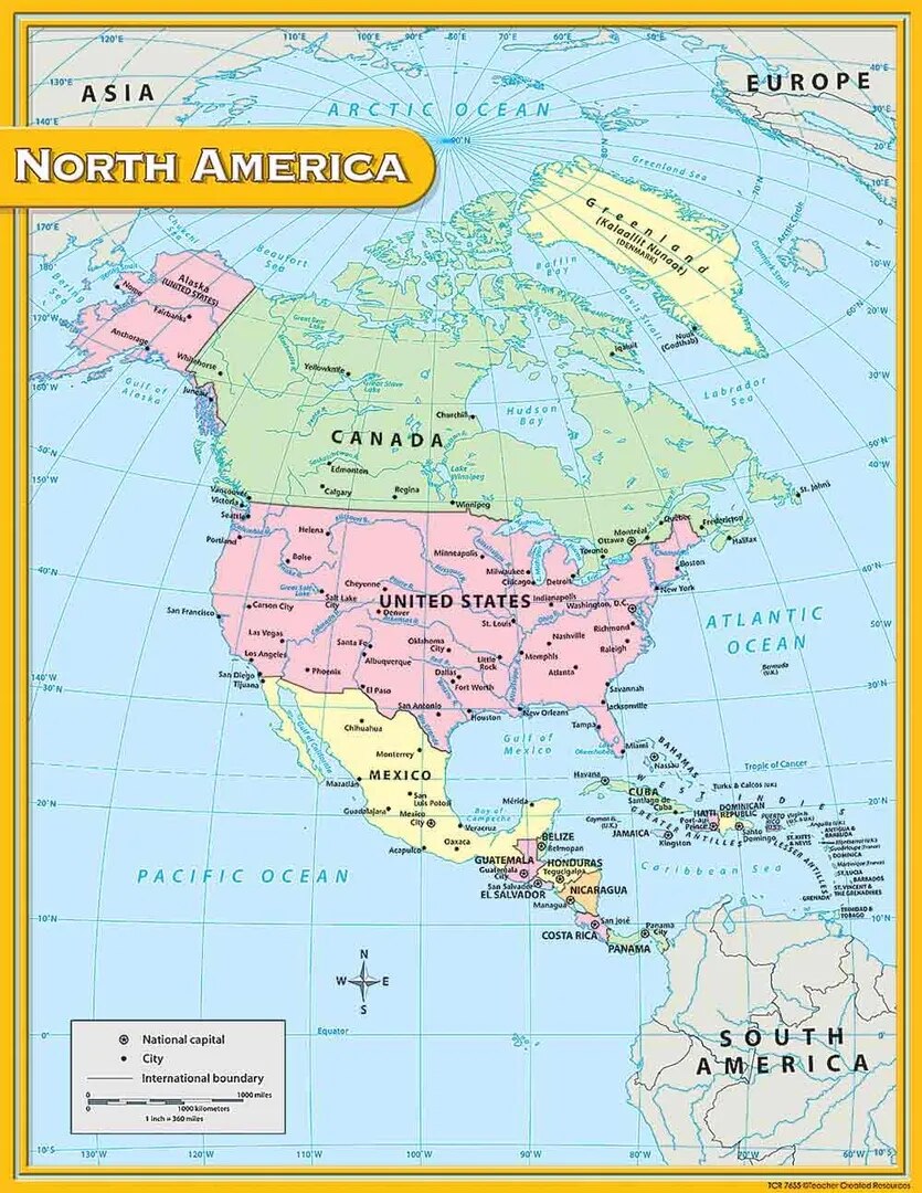
North America Political Map (100x70cm)
Description
The “North America Political Map (100x70cm)” is a large-format educational wall map showing the political boundaries, countries, and capitals of North America, optimized for classroom or lab display at 100×70 cm.
Map Content Overview
Title: North America Political Map
Size: 100×70 cm (suitable for detailed country and boundary depiction)
Key Map Features:
Country boundaries with distinct colors for the United States, Canada, Mexico, and the nations of Central America and the Caribbean
Major countries and all their capitals (Washington, Ottawa, Mexico City, etc.) clearly labeled
Prominent major cities, main administrative divisions (states, provinces, territories), and smaller countries/islands clearly marked
Notation of major rivers and lakes (Mississippi, St. Lawrence, Great Lakes) for context
Coastlines and regional seas (Atlantic, Pacific, Gulf of Mexico, Caribbean) labeled
Scale bar, legend, and compass rose for orientation and feature understanding
Educational Use
Used for geography, social studies, and history teaching to help students learn the countries, capitals, and regional geography of North America.
Designed for maximum legibility and clarity from a distance, with ample color contrast and large text for student reference.
For printing:
High-resolution or vector map for sharp lines and readable names at large scale
Legend for political boundary color coding and capital symbols should be included
Further content customization (bilingual labeling, emphasis on Caribbean nations, or state/province boundaries) is available as needed.
Specifications
| Model No. | N-C129 |
|---|


