
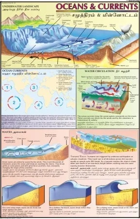
Ocean & Currents (50x70cm)
Description
The “Ocean & Currents (50x70cm)” chart is a detailed educational wall chart illustrating the major ocean currents of the world, designed for classroom or academic use.
Description
Size: 50 x 70 cm
Material: Printed in multicolor, often on quality map litho paper (typically 80 GSM) and thermally laminated on both sides for durability.
Features:
Shows a world map with clearly marked major warm and cold ocean currents, using distinct colors and directional arrows for clarity.
Labeled with names of key currents like Gulf Stream, Kuroshio, Humboldt, etc.
Sometimes includes explanatory notes on what ocean currents are, how they are formed, and their significance to climate, marine life, and human activity.
Available in multiple languages (such as English and Hindi).
Designed to be easy to read and understand, suitable for use in classrooms and other learning environments.
Some charts come with rollers for easy wall-mounting.
Educational Use
Facilitates understanding of the movement of seawater, the difference between warm and cold currents, and their global distribution.
Useful for teaching about climatic zones, ecological systems, and the influence of ocean currents on weather and marine biodiversity.
This chart is commonly recommended as an awareness and reference material for institutes, helping spread knowledge about oceanic systems and geography
Specifications
| Model No. | N-C170 |
|---|


