
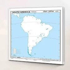
South America Physical Map (100x70cm)
Description
The “South America Physical Map (100x70cm)” is a large-format educational map that highlights the continent’s physical geography, including landforms, water bodies, and major natural features, tailored for classroom or laboratory wall display at 100×70 cm.
Map Content Overview
Title: South America Physical Map
Size: 100×70 cm (enables clear and detailed physical feature display)
Key Map Features:
Relief shading or color gradation representing mountains (Andes, Brazilian Highlands, Patagonian Plateau), valleys, plains (Amazon Basin, Pampas, Gran Chaco), and deserts (Atacama, Sechura)
Major rivers (Amazon, Paraná, Orinoco, São Francisco) and lakes (Lake Titicaca, Maracaibo, Poopó)
Vegetation zones and biomes overlays (rainforests, savannas, deserts, grasslands)
Notable geographic regions: Patagonia, Guiana Highlands, Mato Grosso Plateau
Surrounding ocean and sea labels (Atlantic, Pacific, Caribbean Sea)
Legend for elevation, terrain, and physical symbols
Educational Use
Essential for geography and environmental science teaching to illustrate South America’s topography, water systems, and biome diversity.
Designed for high legibility with distinct terrain shading and clear labeling from a distance.
For print:
Use high-resolution vector or raster source to ensure clarity and color distinction at classroom scale
Be sure to include legends, scale bars, and orientation markers
Further customization such as focus on specific features, environmental overlays, or additional labeling is available on request.
Specifications
| Model No. | N-C128 |
|---|


